
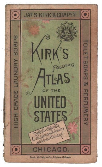
Kirk's Folding Atlas of the United States
Chicago: Jas. S. Kirk & Comp'y, 1884.
Softcover. Very good. Single sheet printed in black, pink, and green. 8.5" x 20", folding to 2.75" x 5". Creases from folding, a few short tears. On one side is a map of the United States engraved by Rand McNally, listing the ranking of each state in production of various crops, livestock, and other commodities, color coded to also show how each state voted in the 1880 election. The verso offers a table of statistical information from the 1880 Census (ranking of states by population, size, number of males, females, white, colored, native, and foreign born), another table "showing the Average Annual Product, in Dollars, of the Principal Farm Crops in each state from 1878 to 1883," and a view of the Jas. S. Kirk & Comp'y building in Chicago. Liberally sprinkled across both sides are blurbs touting the virtues of the company's soaps, colognes, and glycerine products. Not recorded in OCLC.
Item #14118
Sold