

Report of the Superintendent of the Coast Survey, Showing the Progress of the Survey During the Year 1853
Washington: Robert Armstrong, 1854.
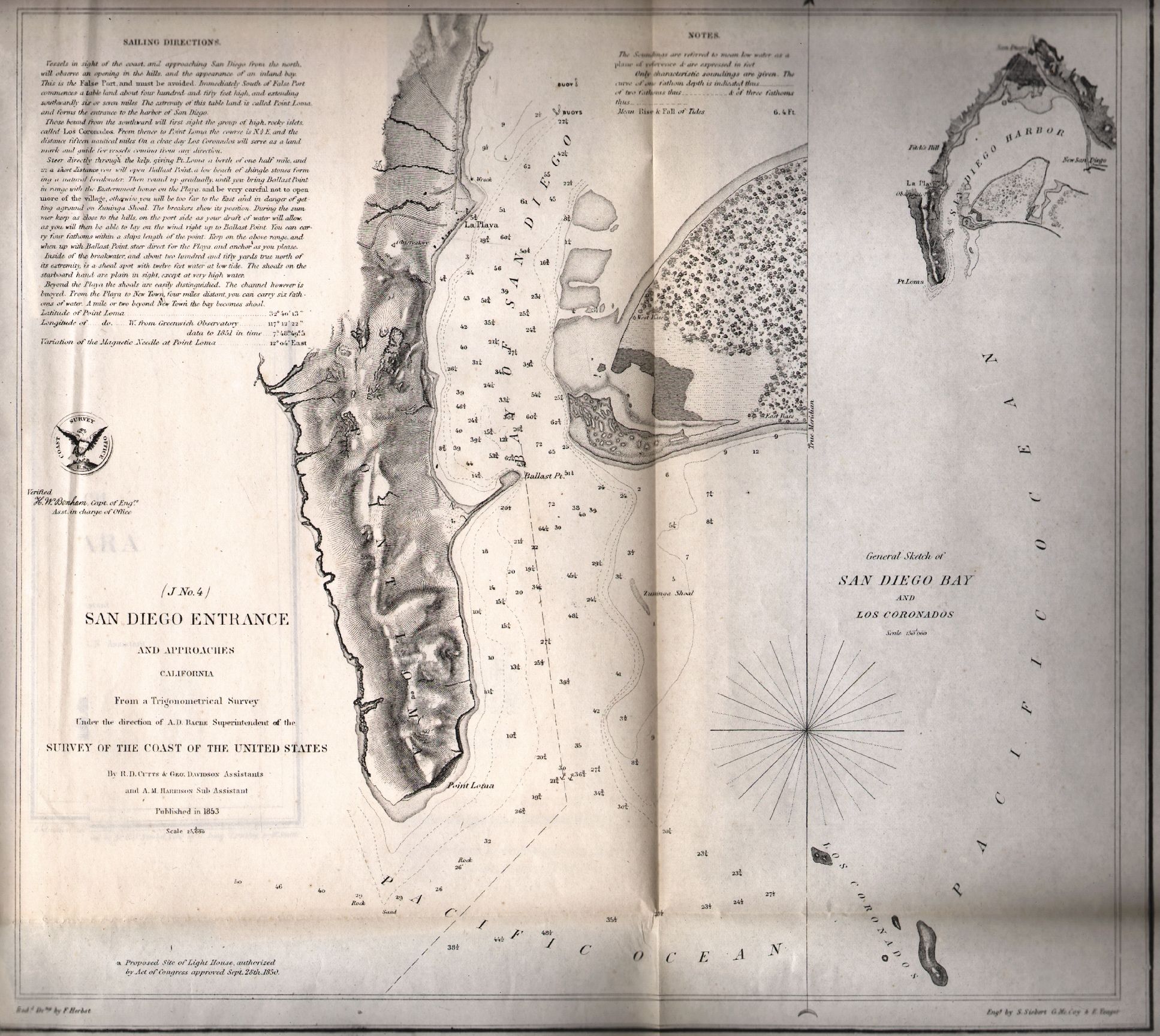
4to, pp iv, 186, complete with 54 folding maps, charts, and tables. Original brown with gilt titles. Some foxing in the text, some charts mis-folded, a few with tears or small splits at the intersections, but overall very good. The surveys covered by this report include the Atlantic, Gulf and California coasts. Among the notable maps are the Cape Fear River, Galveston Harbor, San Diego, San Francisco Bay and Vicinity, Santa Barbara (Preliminary Sketch), and the north coast of Washington State, including Cape Flattery. This copy has the bookplate of the Bureau of Navigation, Navy Department and compliments label of Prof. A.D. Bache (Superintendent of the Coast Survey) on the front pastedown.
Item #18147
Sold