

Johnson's New Illustrated Family Atlas of the World, with Physical Geography, and with Descriptions Geographical, Statistical, and Historical, Including the Latest Federal Census, A Geographical Index, and a Chronological History of the Civil War in America
New York: Johnson and Ward, 1866.
Folio (ca. 14.5 x 18.5 inches), 131 pp (text) + table of distances and one ad page, 105 maps and plates (complete). Original green cloth boards with leather spine and corners, gilt lettering and seal of the United States on upper board, marbled endpapers. Light rubbing to extremities, old tape repairs to title page, two maps (Ohio and Pennsylvania) split at centerfold, one with tiny loss, otherwise a very nice copy, clean and sound, with bright hand coloring throughout.
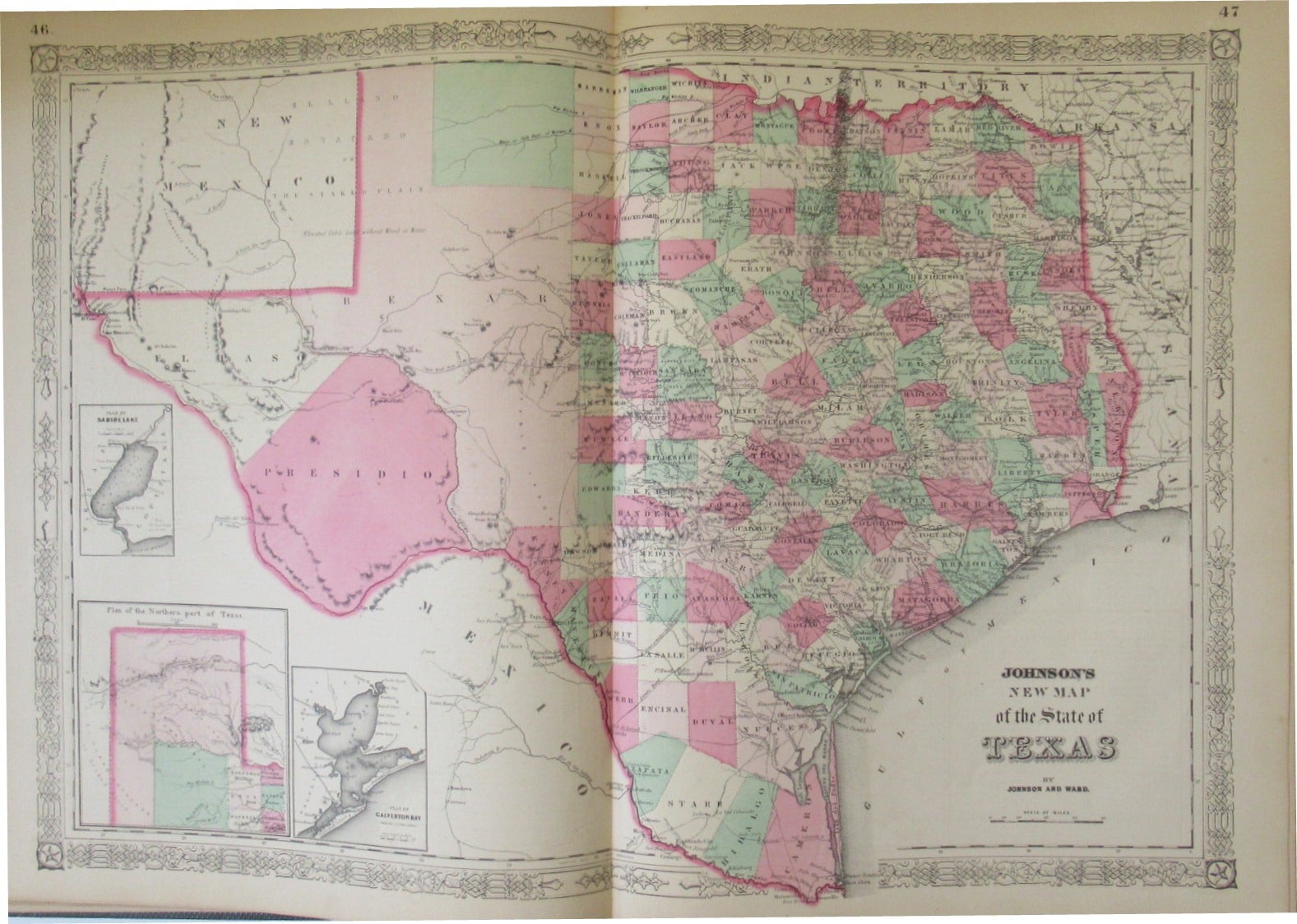
First published in 1860, Johnson’s Family Atlas was revised repeatedly as the growth of the railroads and the exploration and settlement of the West made updated maps a necessity. This post-Civil War edition includes the “Map of the Vicinity of Richmond and Peninsular Campaign in Virginia.” The double-page “New Map of the State of Texas” shows county development to the eastern border of the panhandle, with the vast western portion of the state divided only into the regions of Presidio, El Paso, and Bexar. Nebraska, Dakota Territory, Idaho, and Montana are shown on one double-page map, with Idaho taking up much of what is now western Wyoming and all of western Nebraska labeled as “Mauvaises Terres or Bad Lands covered with stinted grass.” The entire continents of South America, Africa, and Australia receive just one double-page map each. European countries are shown individually, and Asia is covered by six maps (an overview of the continent; Palestine; Turkey and the Middle East; India--with Burma, Laos, and Siam; China; and Japan).
Item #20063
Sold