
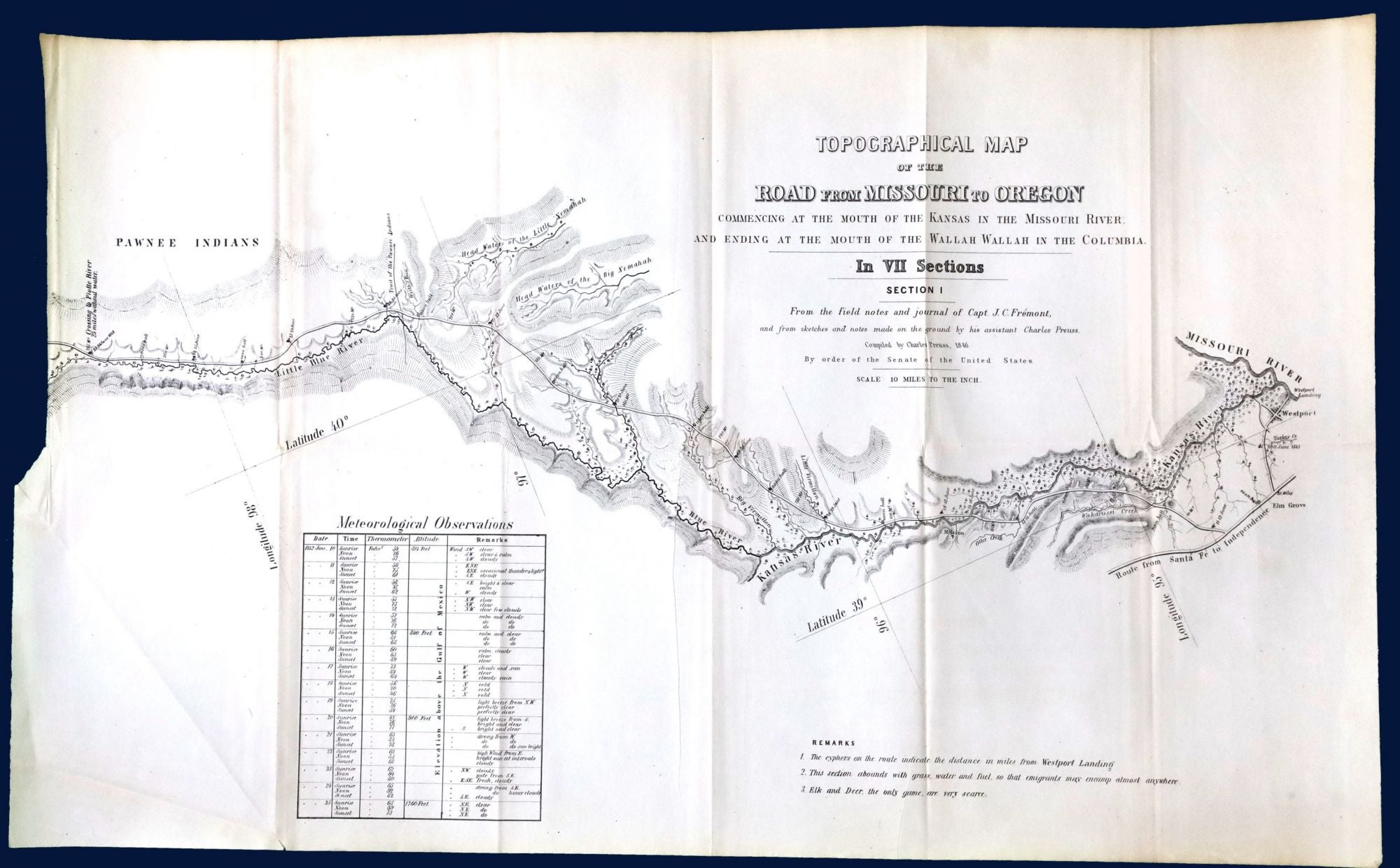
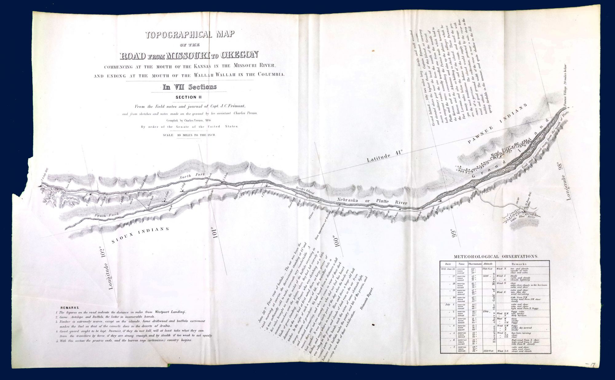
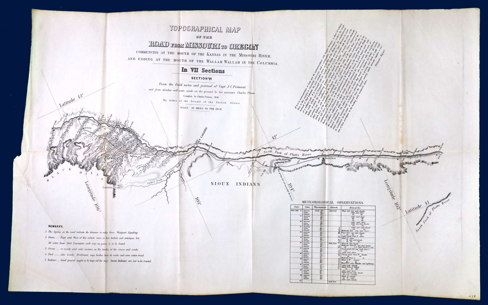
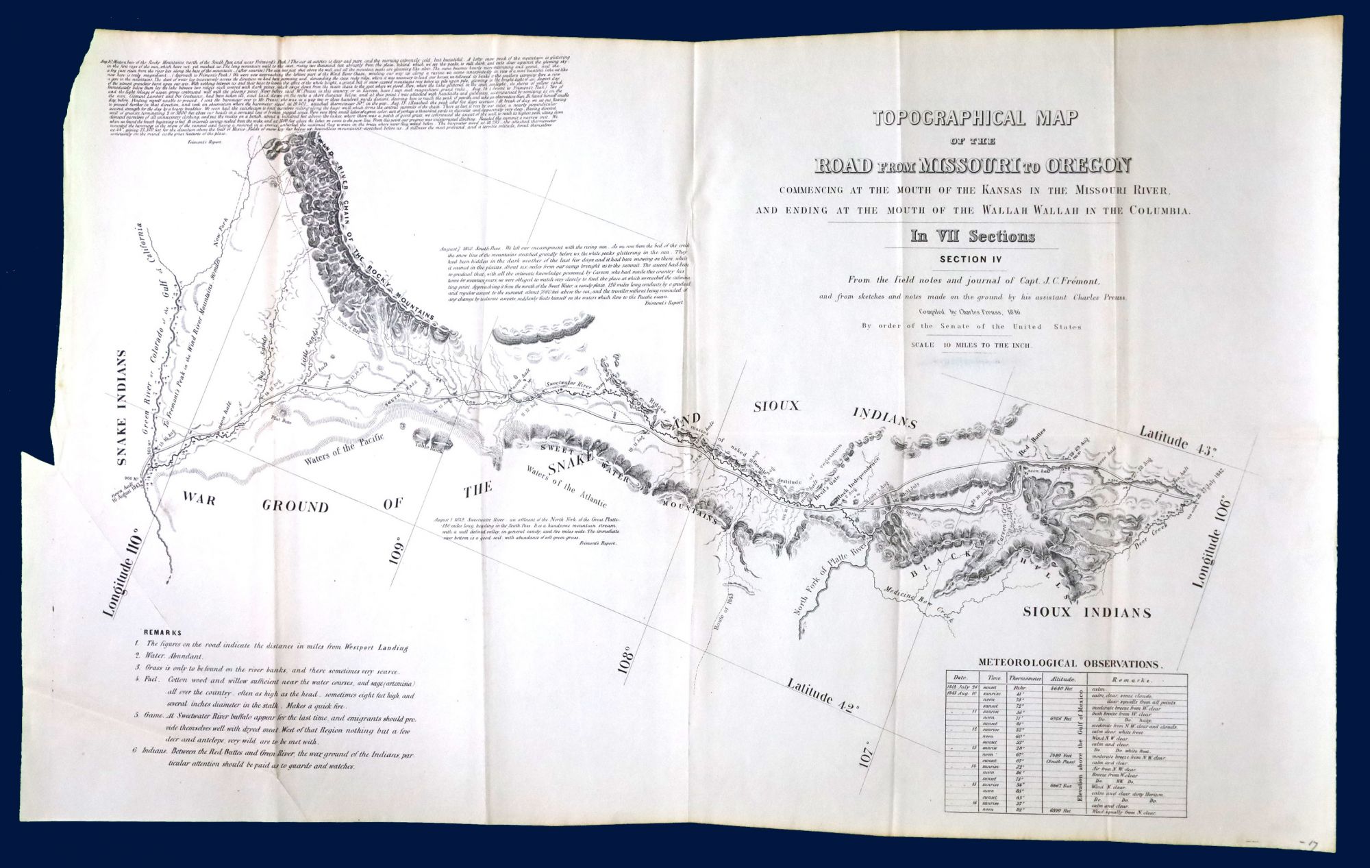
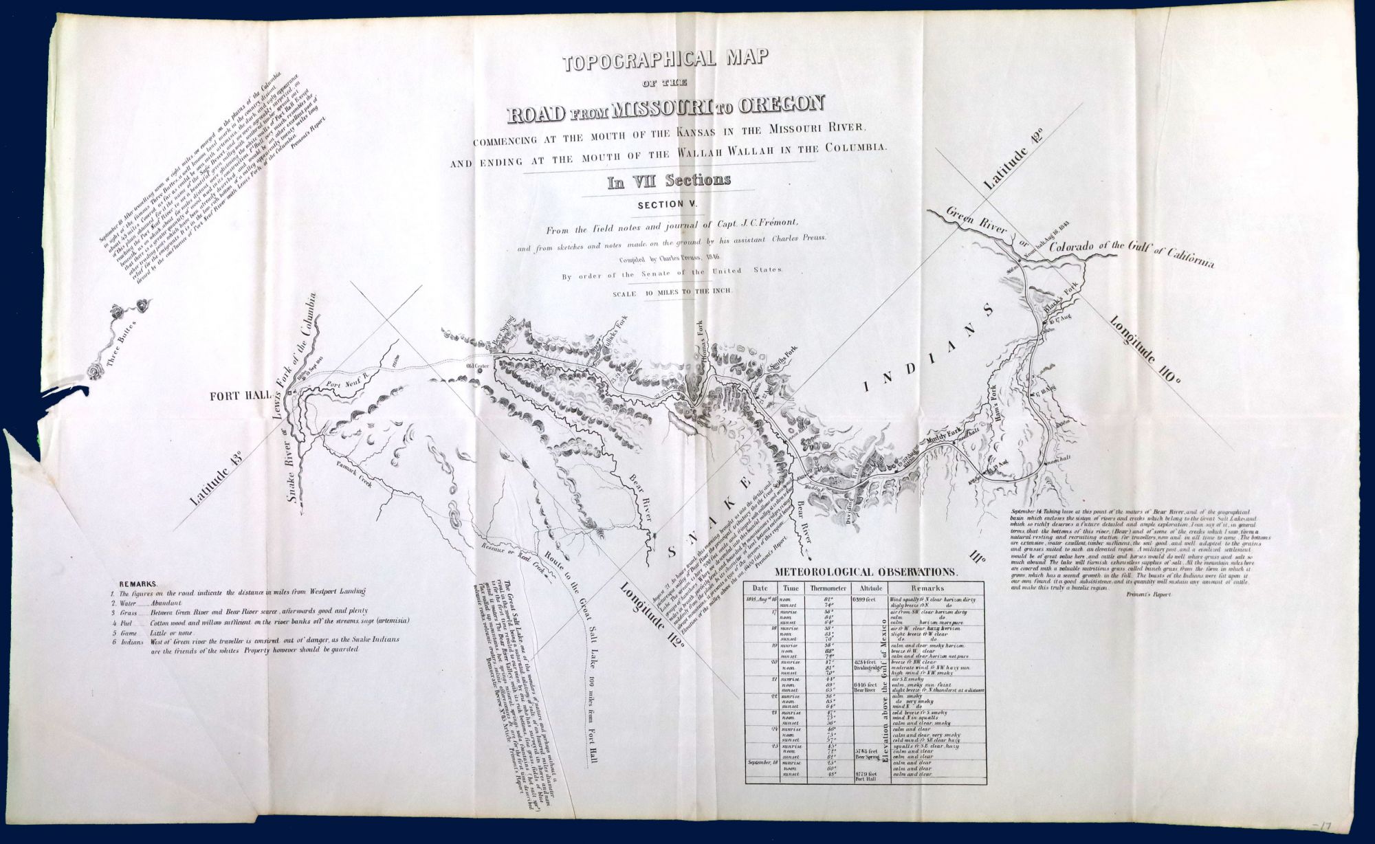
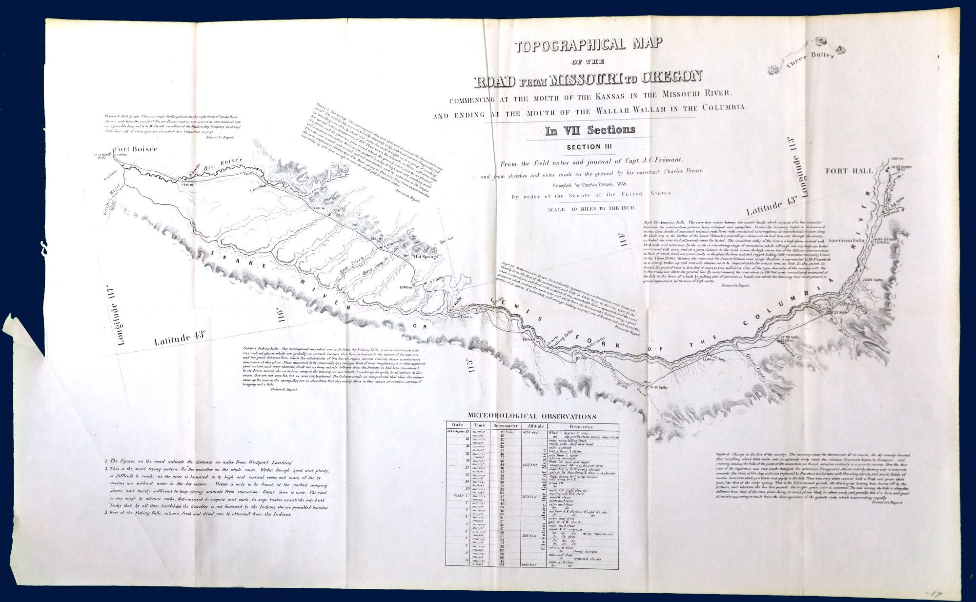
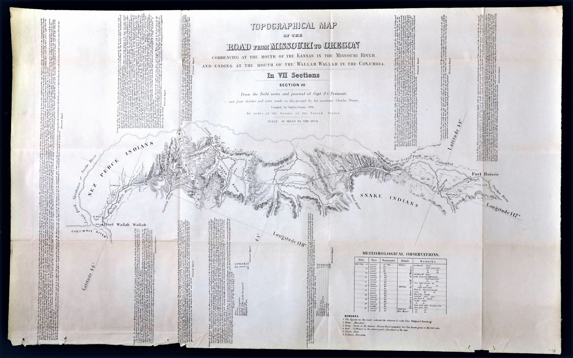
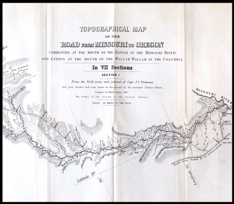
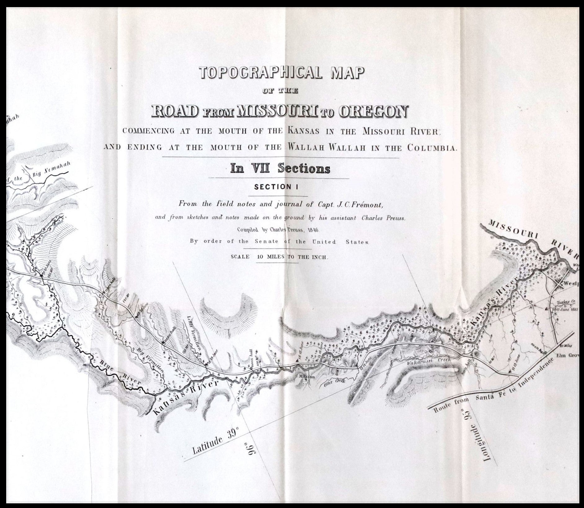
Topographical Map of the Road From Missouri To Oregon Commencing at the Mouth of the Kansas in the Missouri River and Ending at the Mouth of the Wallah Wallah in the Columbia
Washington: 1849.
Very good. Lithograph map in seven sections, with each sheet measuring approximately 15.5 x 25 inches. Not bound. Second issue of this monumental and important map of the Oregon Trail, described by Wheat as "a road guide for Oregon emigrants such as had never previously existed." The second issue is nearly identical to the first (which appeared in 1846), but the lithographer's name has been omitted and the numbering of sheets III and VI is reversed. An exceptionally clean set, with no splits or repairs, and almost none of the toning often seen along the folds. Charles Preuss was a Prussian-born surveyor and cartographer who accompanied John C. Fremont on three of his five exploratory expeditions in the American West. His first great map, illustrating Fremont's explorations of 1842 to the Rocky Mountains and of 1843-44 to Oregon and California, was published in 1845. Fremont set off on his third expedition later that year, but Preuss remained behind, using information compiled during the previous expeditions to develop this new, more detailed map Described by historian William Goetzmann as "one of Fremont's and Preuss' greatest contributions to the development of the West," the map is constructed at a scale of just ten miles to the inch, with each section covering about 250 miles of the route. Preuss provided excerpts from Fremont's narrative and additional notations that anticipated the needs of travelers, with details on topography, weather, location of game, forage, and sources of water and fuel. This information had not previously been readily available to travelers, and the map was put to good used many of the overland trail parties (see Rumsey, 2773). Graff 3360: "An extraordinary map by a master cartographer." Wheat (Mapping the Transmississippi West, 523): "The purview of each section is quite narrowly limited to the emigrant road, but the topography is developed in rather more detail than on the parent map.... Owing to its rarity and to its having long stood in the shadow of the much more widely known and distributed Fremont map of 1845, Preuss' sectional map of 1846 has been insufficiently appreciated by students of Western history. In particular, those interested either in Fremont's travels of 1842-43 or in the evolution of the transcontinental wagon roads will find that the map rewards close study."
Item #22103
Price: $2,750.00